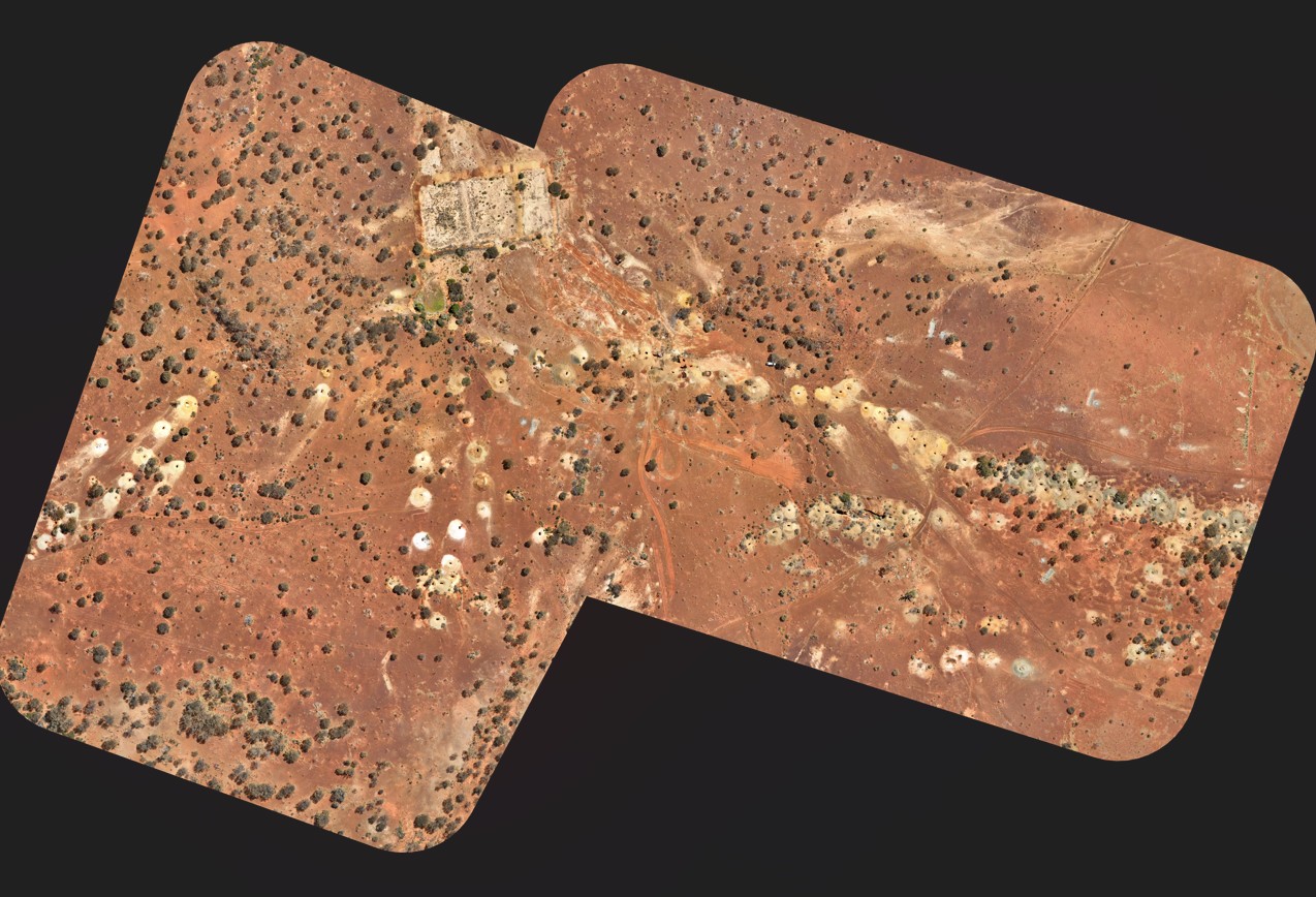
Aerial Surveying & Mapping
Our aerial surveying and mapping services leverage the latest drone technology to capture high-resolution imagery. Delivering precise and detailed outputs for a wide range of applications, including:
- 3D Models & Point Clouds
- CAD Outputs
- Contour Lines
- Georeferenced Ortho Imagery
- Environmental Monitoring
- Volume Calculations
- As-Constructed Conformance Reports
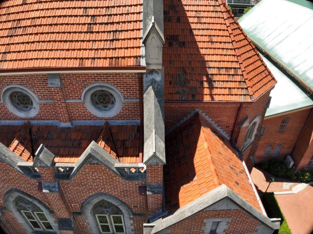
Drone Inspections
Our aerial inspection services provide live, real-time inspections in areas that are dangerous, inaccessible, or otherwise costly to access.
- Building & roof inspections
- Utilities and telecommunication towers
- Infrastructure inspections

Drone Photography & Videography
Utilising the latest drones equipped with high-resolution cameras, we are able to provide professional aerial imagery and videography services to suit almost any application across Perth and Western Australia.
- Captivating footage for marketing purposes.
- Dynamic shots for television production.
- Comprehensive visual documentation of project progression.

Surveying Services
At UAV Survey WA, we offer a range of surveying services. Speak to us today about your projects requirements.
- Construction setout
- As-built surveys
- Feature surveys