Accurate Drone Mapping & Aerial Surveying Across Perth & Western Australia
At UAV Survey WA, we deliver accurate and reliable aerial surveying and mapping services across Perth and Western Australia. Using advanced drone technology, we capture high-resolution aerial data to provide actionable insights for industries such as construction, mining, agriculture, and environmental management.
Why Choose Drones for Your Mapping Needs?
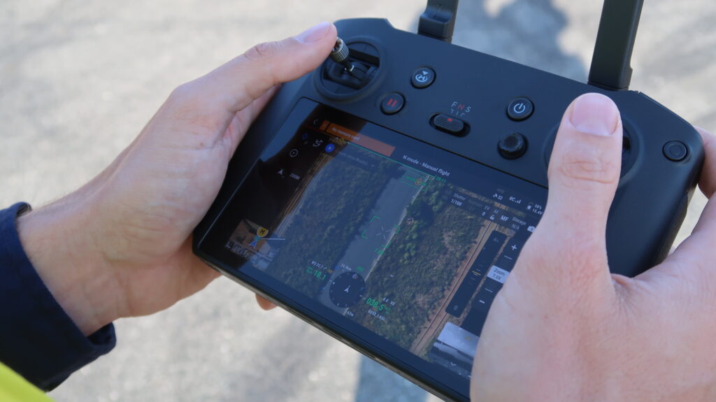
Traditional surveying methods can be time-consuming, costly, and sometimes dangerous. With our drone surveying services, you can achieve faster results, lower costs, and enhanced safety, especially in hard-to-reach or hazardous areas. Our drones are equipped with high-resolution cameras and advanced GPS technology, enabling us to capture detailed imagery and data with centimeter level accuracy.
Our Aerial Surveying and Mapping Services Include:
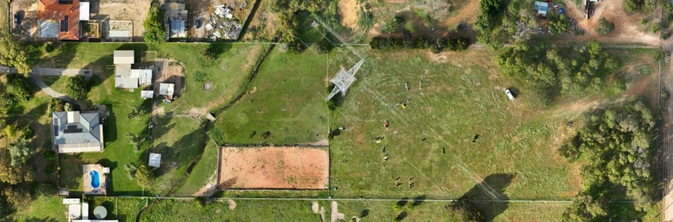
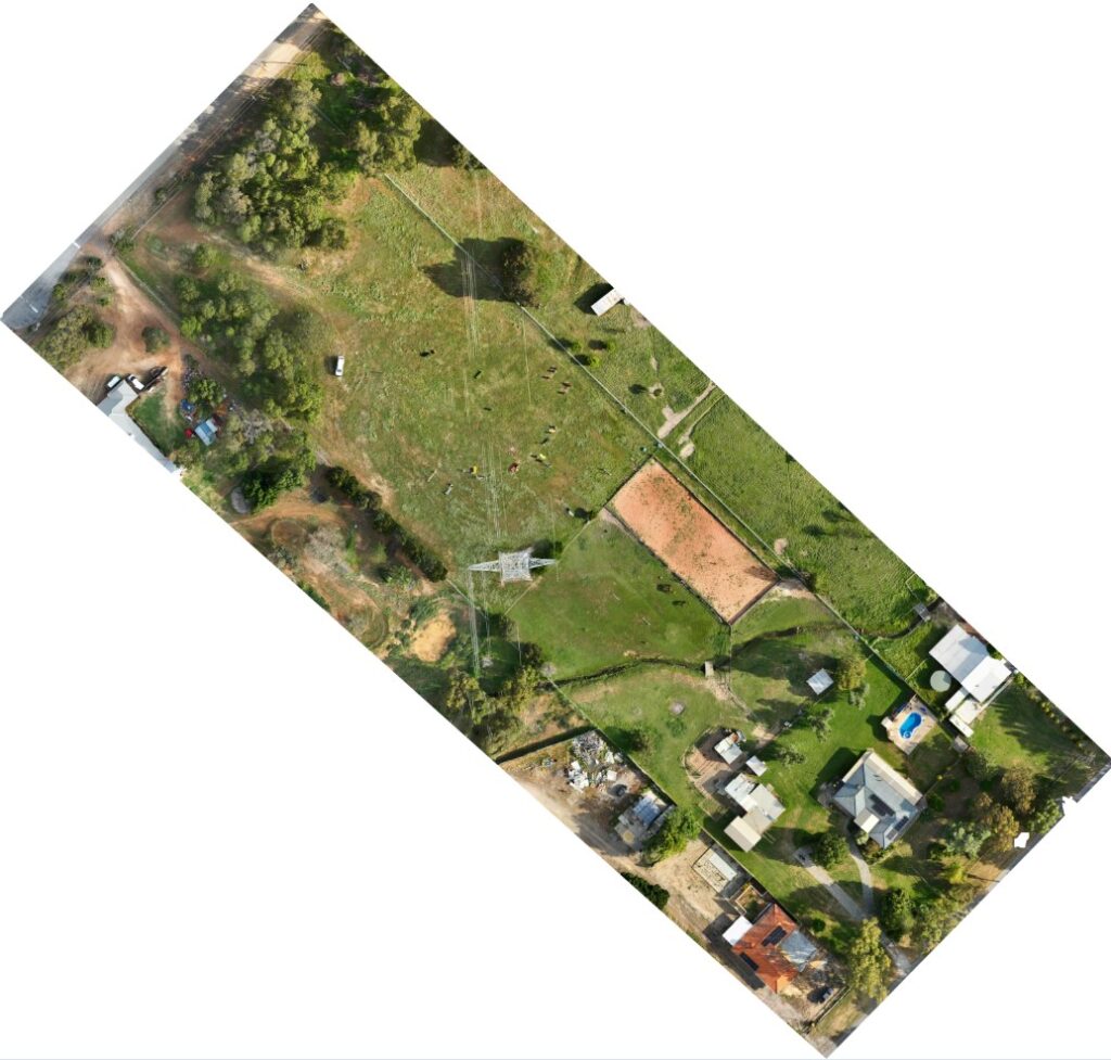
Orthomosaic Images
Our orthomosaic images provide high-resolution, true-to-scale aerial imagery that can be used for planning, inspections and reporting. Every image is processed with survey-grade accuracy, allowing you to measure distances, areas and features with confidence. This is ideal for construction progress monitoring, asset inspections, environmental sites and agricultural mapping.
3D Modelling & Point Clouds
We create highly detailed 3D models and point clouds of sites, structures and terrain using advanced drone photogrammetry. These models are suitable for planning, design work, cut and fill analysis, clash detection, and presenting visual data to clients or stakeholders. All 3D outputs can be delivered in industry-standard formats including LAS, OBJ, DXF and more.
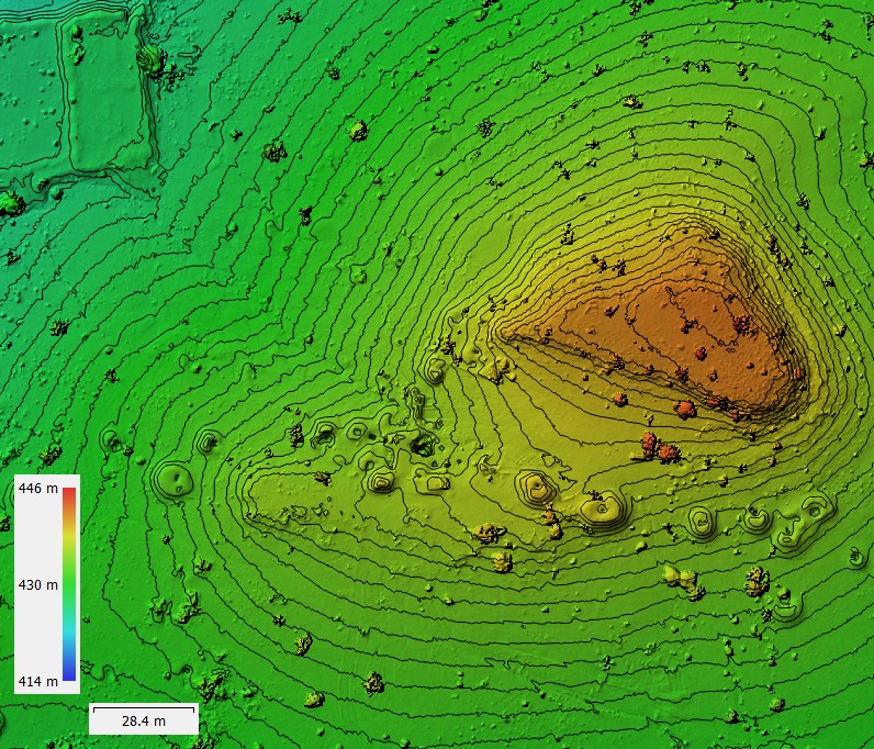
Digital Elevation Models (DTM & DSM)
Our Digital Elevation Models accurately represent both terrain surfaces (DTM) and surface objects such as vegetation and structures (DSM). These high-accuracy models support engineering design, drainage analysis, planning applications, environmental management and mining workflows. Elevation data is processed using survey control for maximum accuracy.
Contour Mapping
We generate precise contour lines from drone-captured elevation data, providing a clear understanding of site gradients and terrain changes. Contours can be customised to any interval required for planning, design or construction. All data can be provided in CAD-ready formats for seamless integration with your existing design workflow.
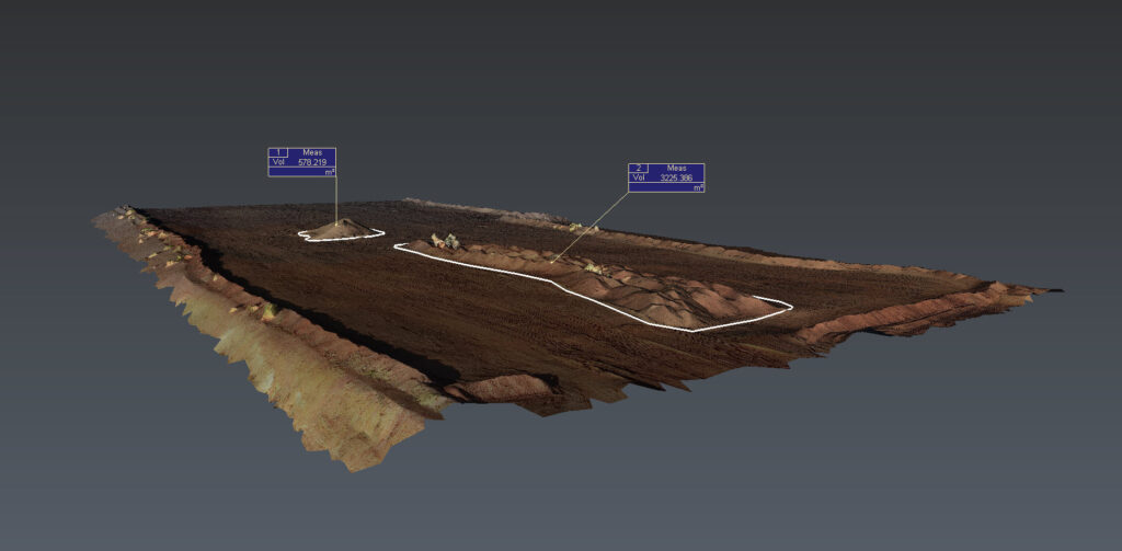
Stockpile & Volume Measurement
Drone-based volume measurements offer a faster, safer and more accurate alternative to traditional survey methods. We calculate the volumes of stockpiles, excavations, fill areas and pits using dense point clouds and digital terrain modelling. This service is ideal for quarries, mines, civil construction and earthworks contractors who need reliable volume reporting.
Progress Monitoring & Site Documentation
Regular aerial surveys provide an up-to-date record of site conditions, construction progress and asset performance. Our drone data allows you to compare stages over time, detect changes, monitor earthworks, verify contractor output and generate visual documentation for stakeholders. Reports can be delivered weekly, fortnightly or monthly.
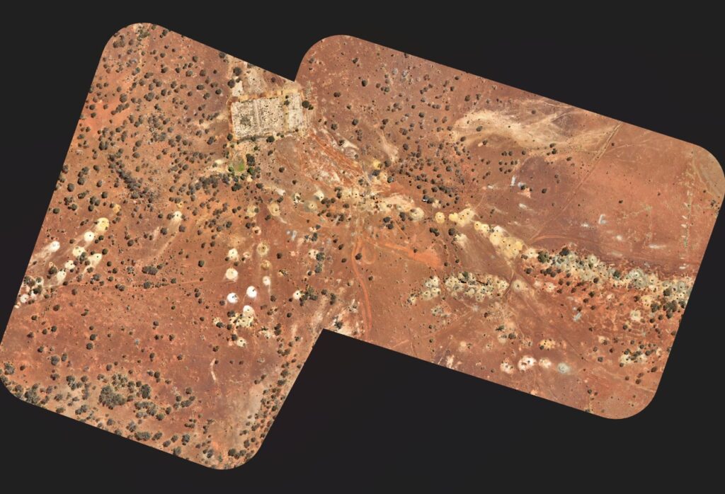
Environmental & Agricultural Mapping
RGB drone imagery supports vegetation mapping, erosion monitoring, and crop analysis. These outputs assist with land management, rehabilitation projects, and environmental compliance reporting.
Applications of Our Drone Surveying and Mapping Services:
Our drone survey and mapping services are versatile and can be applied to various industries, including:
- Construction: Precise site analysis, topographic surveys, and progress tracking.
- Mining: Stockpile measurements, mine site mapping, and volumetric analysis.
- Agriculture: Crop monitoring, land management, and environmental assessment.
- Infrastructure: Inspection of roads, bridges, utilities, and telecommunication towers.
Why Choose UAV Survey WA?
With years of experience in the surveying industry, our team of certified surveyors ensure the highest accuracy, efficiency, and safety in every project. We use the latest drone technology and aerial mapping software to deliver reliable and high-quality results, tailored to meet your specific needs.
Key Benefits:
- Fast and accurate results with drone technology.
- Reduced risks and costs compared to traditional surveying methods.
- High-quality orthomosaic maps, 3D models, and topographic surveys.
- Expertise in various industries including construction, mining, agriculture, and infrastructure.